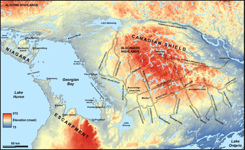
Figure 1- Map of Colonization Roads which neighbour Georgian Bay and cover the periphery of the Canadian Shield. Notably find Victoria Road just to the East (right) of Lake Simcoe.
Victoria Road is one of the many colonization roads that dot the southern periphery of the Canadian Shield (Figure 1). These roads demonstrate the will to utilize the wilderness surrounding Georgian Bay for agriculture and settlement. Unfortunately, the high basement rock and lack of soil across the region made it generally unsuitable for agriculture. This was despite generous programs, such as the Free Grants Act in 1869, devised to incentivise the development of the area, offering titles for 100-200 hectares of land for any person willing to clear the land and build a log cabin. In W.C. Pollard’s memoir, titled Life on the Frontier(1910), he describes the realization many had regarding their prospects. He wrote
‘When the majority realized just where they were and the prospects ahead, they marveled that they had ever attempted to remain among the rocks of the Parry Sound District.’
Travelling along these colonization roads now you can find relics, such as broken-down log homes, illustrating that geology had prevailed (Figure 2). However, in certain cases aspiring farmers were met with workable land allowing for the creation of small communities that persist to this day. Again, geology was to blame. The deposition of lacustrine (lake) sediments left behind by large glacial lakes, which previously covered the region, created pockets of arable land amongst the hard crystalline rock surface of the Canadian Shield.
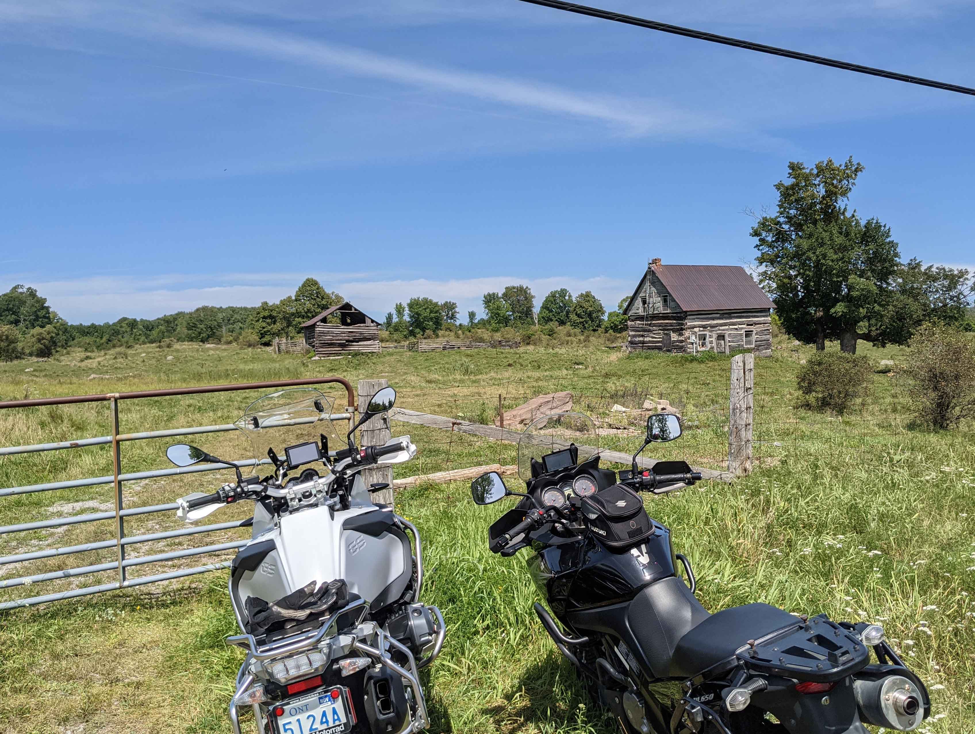
Figure 2- Remnants of failed settlements visible from the road
Victoria Road, or Highway 35, can be found just northwest of Balsam Lake, extending from Monck Road to Talbot River Road, just before Highway 48. This is one of the many colonization roads you can find and travel down in the area. Look for the sign on the northern end of the road that marks its beginning (Figure 3).
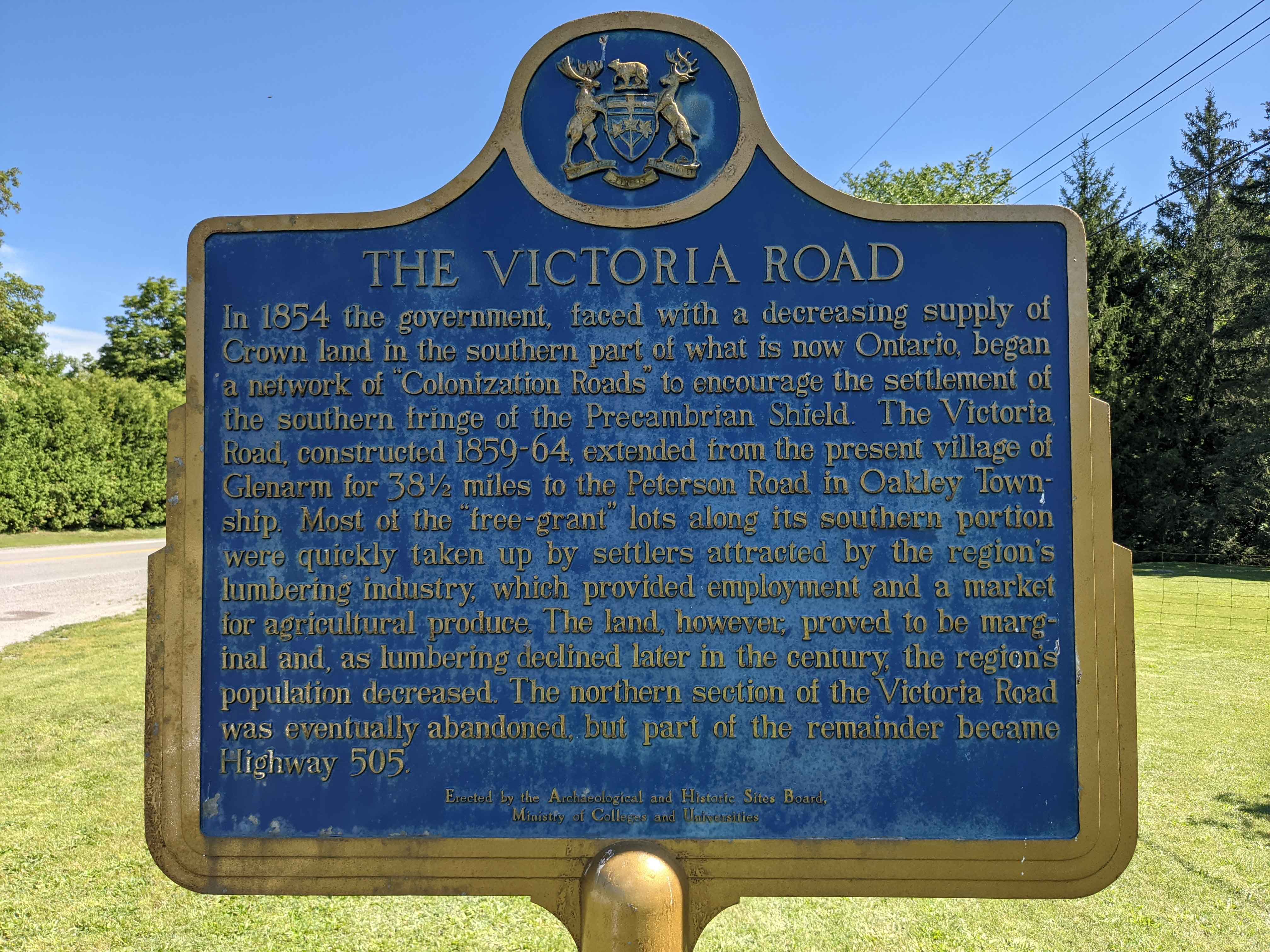
Figure 3- Sign post for the start of the Victoria Road.
Conservation in Carden
Adjacent to the Victoria Road lies the Carden Area. What at first glance may seem like an ordinary section of flat plains and grass are actually a series of wetland and rare environments known as alvars. These are areas of shallow soil emplaced on limestone formations which form unique grassland environments. The Nature Conservancy of Canada, with the help of the Couchiching Conservancy and Carden Field Naturalists, helps manage and protect the rare alvar environments found in the region. Here you can find the Prairie smoke site in the Carden Alvar Natural Area (Figure 4) home to distinct flora and fauna such as grassland bird populations. The Prairie Smoke site offers some of the only trails to explore the Carden Alvars, since most are on private land and/or are inaccessible. The Prairie Smoke site is found just Southeast of Lake Dalrymple on Lake Dalrymple Road, accessible via Kirkland Road.
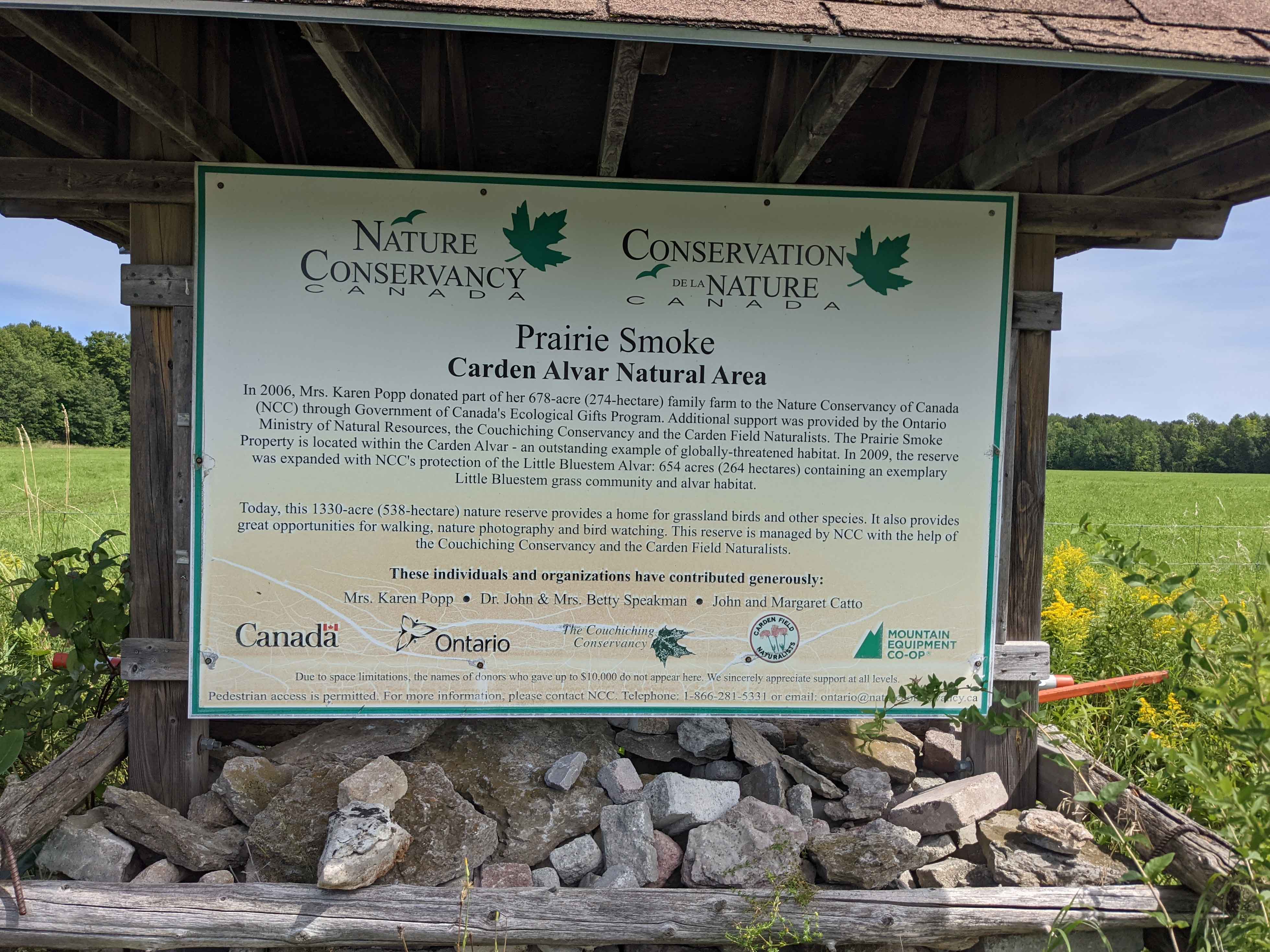
Figure 4- Sign post for the Prairie Smoke area, one of the many designated alvars in the Carden Alvar Natural Area.
At this point you may be wondering, if alvars require a limestone basement where can I find some limestone? Travelling south of the Calden Area you can get a glimpse of limestone outcrops. Ordovician limestone can be found between the Canadian Shield and Lake Ontario, stretching from the Niagara Escarpment to the Ottawa Region. The limestone formations represent periods when the region was covered by warm tropical waters from the Iapetus Ocean which covered Ontario.
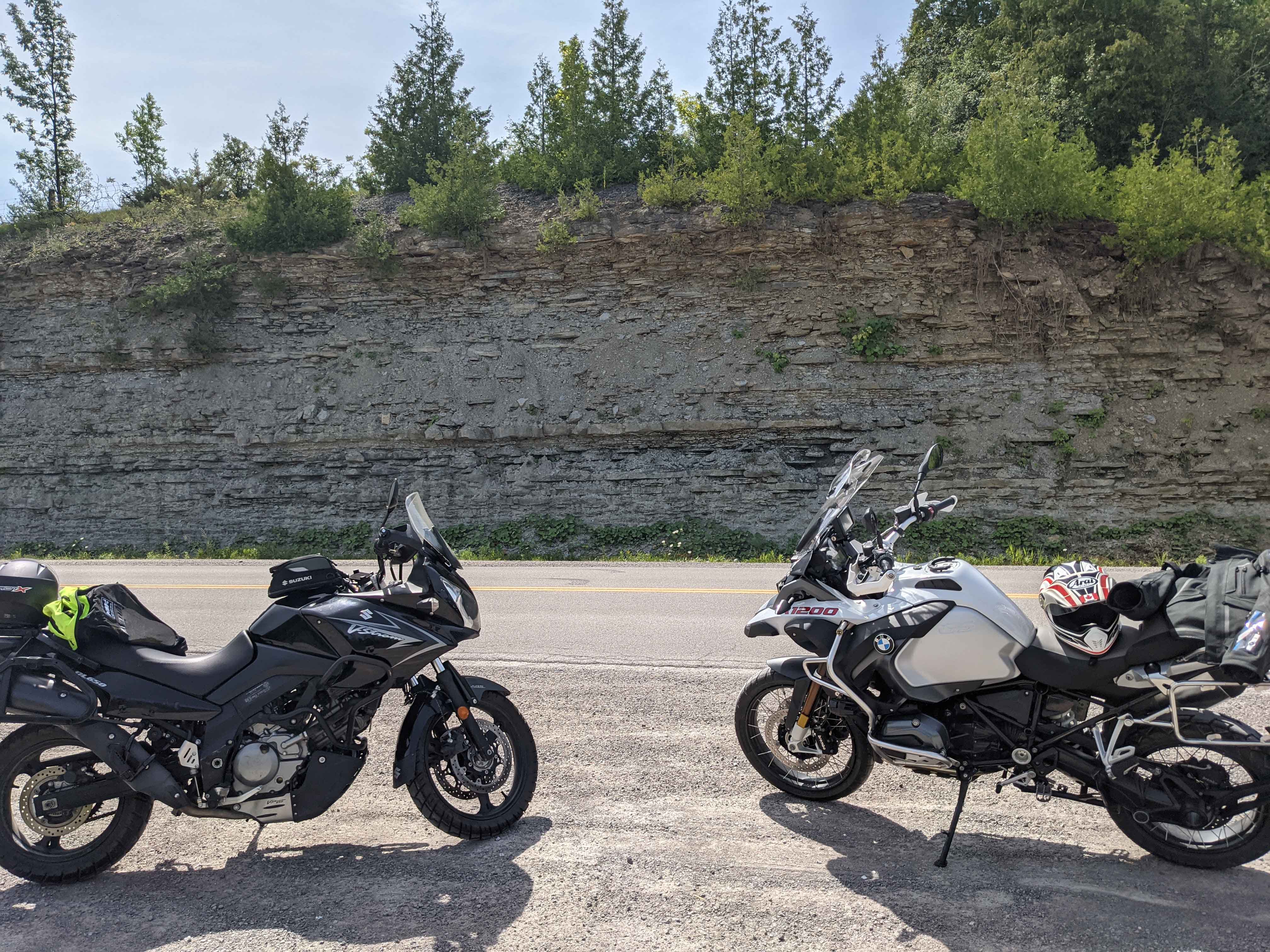
Figure 5- Quick roadside stop to marvel at limestone outcrops and motorcycles.
A trip along the Victoria Road and around the Carden Alvars grants visitors a diverse array of examples demonstrating the geologic control on the environment and human activity. The limestone bedrock in the region provides the unique conditions for alvars to form. On the contrary, the Victoria Road provides an example of geology stunting development. If you ever find yourself travelling down these old colonization roads stop along the road, when safe, and perhaps ponder the words of W.C. Pollard describing what the settlers must have thought upon seeing the impending challenge and their prospects. Safe travels!
Where do I learn more?
Check out the Victoria Road and Carden Alvars sites on the Planet Rocks site!