Image courtesy of Chai Chen.
On July 30th members of the lab assisted lab technicians with the testing of seismic surveying equipment in the UTSC valley. This was in preparation for the upcoming course Exploration Geophysics (EESB21H3) offered this upcoming fall semester at UTSC. Seismic surveying is an example of geophysical methods that can be used to gain a better understanding of the subsurface. It is also one of the several approaches covered in the course in addition to electromagnetic, gravity and ground penetrating radar (GPR) surveying techniques.
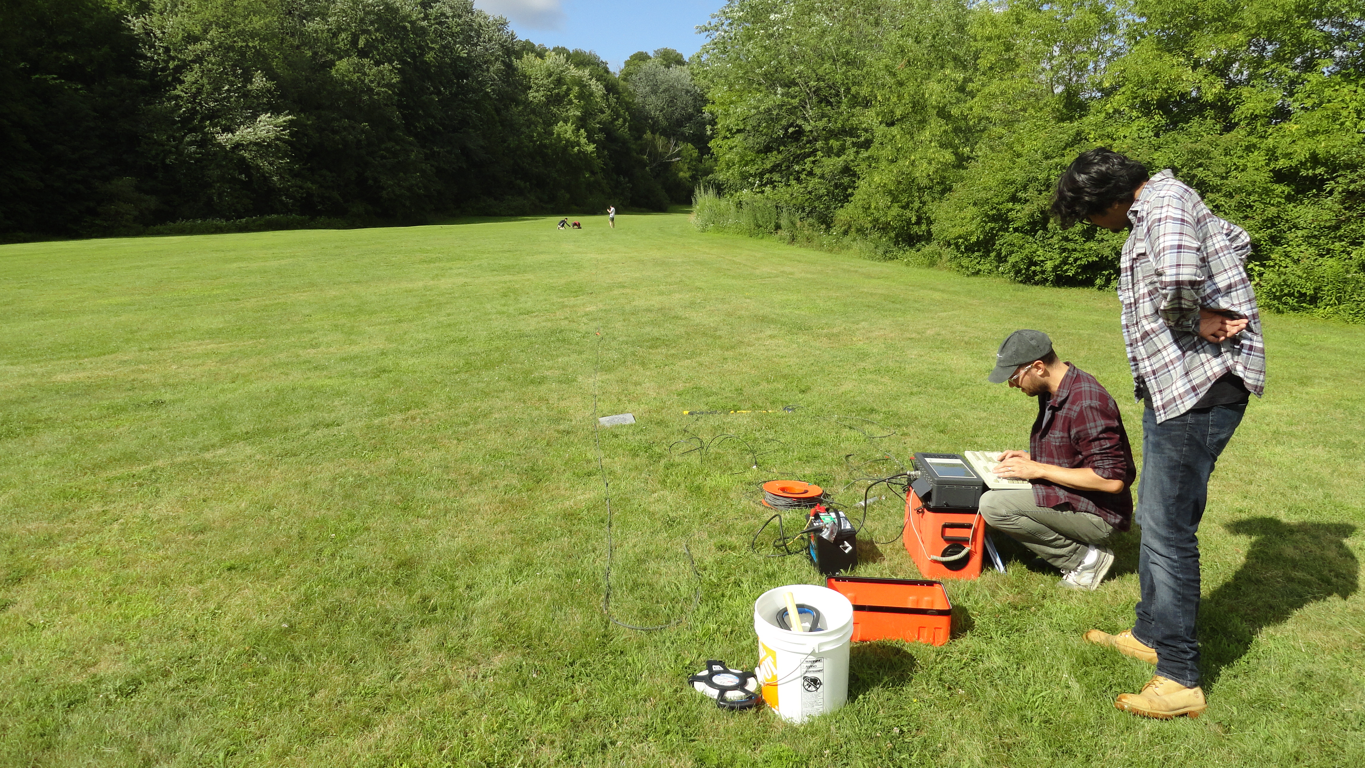
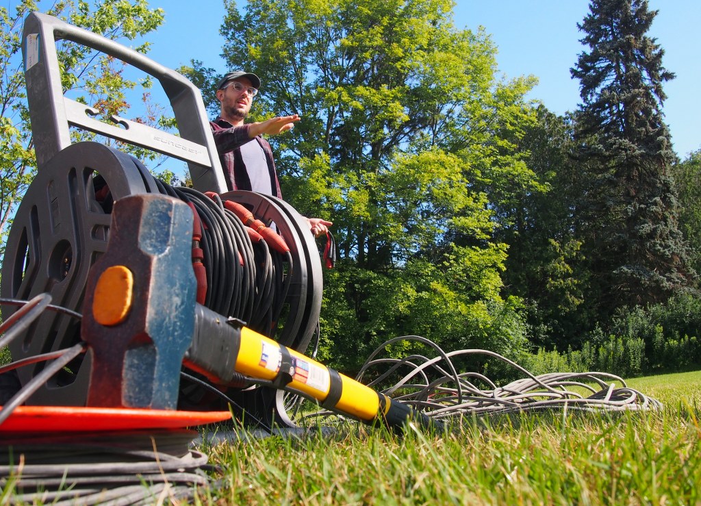
Figure 1- Setting up the system. For reference you can see some of the lab members at the end of the array way into the distance.
So, what is seismic surveying?
Seismic surveying tracks the passage of an acoustic signal through the subsurface. The acoustic properties of the subsurface, which are often correlated with density, affect the speed, and therefore transmission, of the acoustic signal. The deflection of the acoustic signal due to changes in the acoustic character of the subsurface are measured through an approach known as seismic refraction. This is akin to light diffusing through water, changing its path. Simultaneously to the acoustic wave being refracted it is also reflected. The strength of reflection is proportional to the contrast in acoustic properties between the subsurface layers. As a result, if the acoustic signal travels from a layer of loose sediment to bedrock a strong reflective surface will be recorded by the reflection of the acoustic wave back to the surface.
So it seems like there is a lot to keep track of in a seismic survey, how do we actually conduct one?
While it may seem complicated, in essence we only need an acoustic source and a set of receivers to ‘listen’ for the signal.
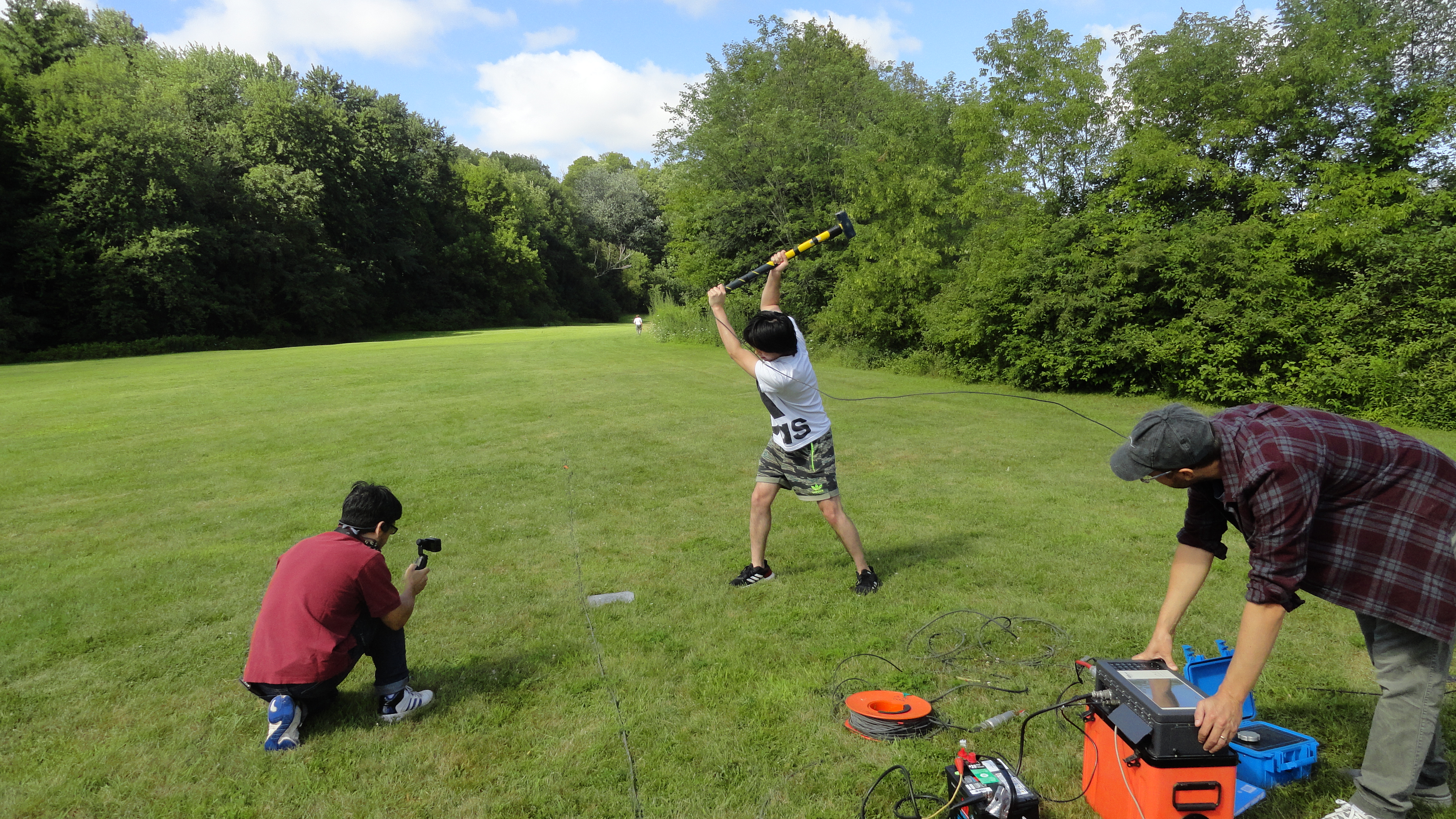
Figure 2- Undergraduate students hard at work generating a seismic signal by striking a metal plate with a big hammer!
In our case we conducted the seismic surveying using a hammer seismic method. For this technique, a large hammer is used to strike a metal plate to produce a large (and loud!) acoustic signal that penetrates the subsurface. The hammer is rigged with a sensor which will trigger the recording from the receivers as soon as the hammer strikes the plate. This means that once the acoustic signal is produced the receivers will being to record. In this case we used a set of 24 geophones that are placed equal distance (5 meters) from one another in a straight line. The geophones capture the acoustic signal as it travels outwards from the site of the hammer strike and along the geophone line.
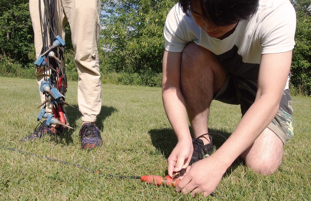
Figure 3- Meticulously attaching geophones along the survey's extent. Image courtesy of Chai Chen.
Data recorded by the geophones can then be used for subsequent seismic refraction and reflection analysis depending on the purpose of the survey. A sample output of survey data provides a representation of refracted and reflected acoustic signals received by each respective geophone.
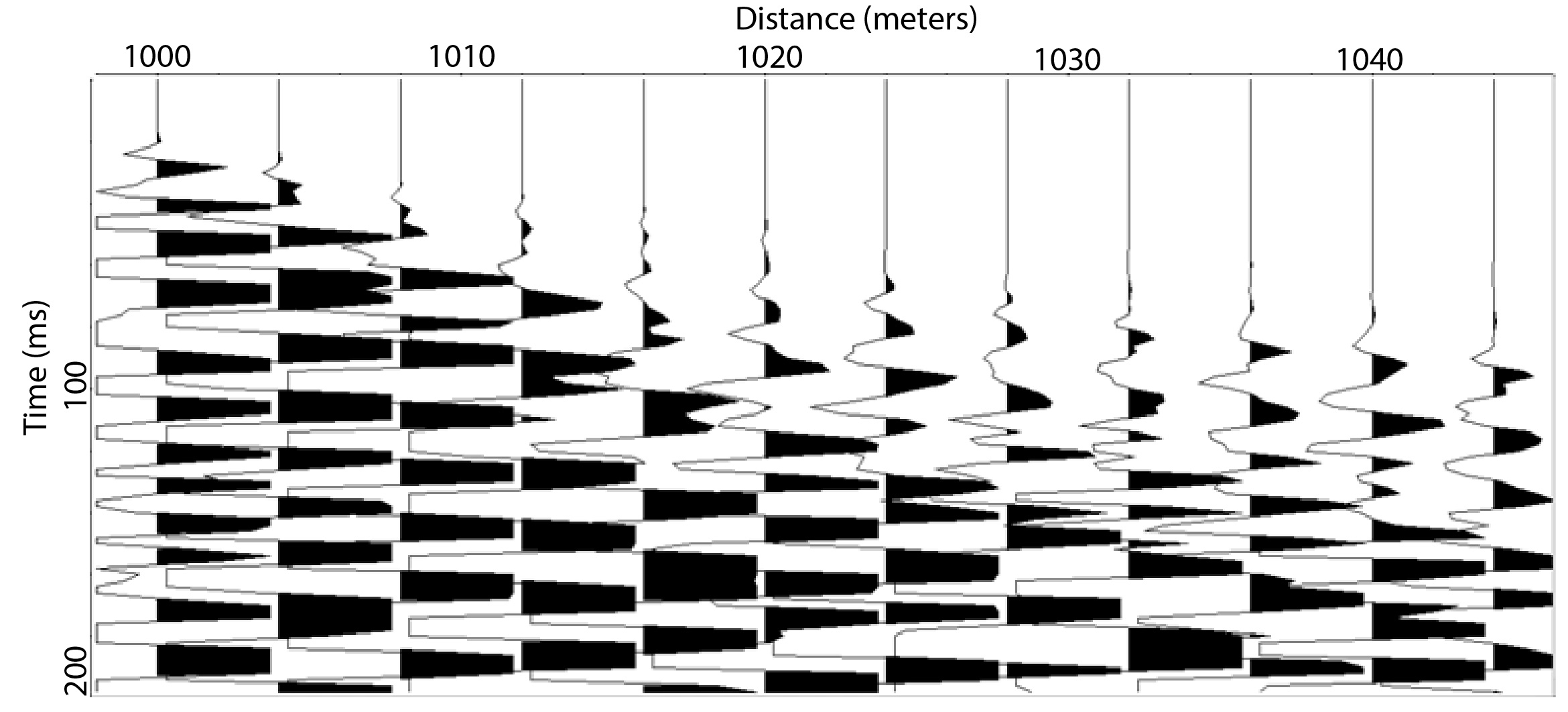
Figure 4- Sample output of the seismic surveying conducted in the valley. The distance away from the source (x-axis) and the time of recording (y-axis) allow can be used in subsequent analysis to infer subsurface layers and properties. Data courtesy of Tom Meulendyk.
Seismic surveying sounds fun, where do I learn more?
This fall the course Exploration Geophysics (EESB21H3) will be offered during the fall semester. This course will grant you the opportunity to learn more about the underlying theory behind the survey techniques you will get to carry out yourself out in the field. So if you like spending time outdoors, being hands-on and using your knowledge of geoscience this course might just be for you!