On July 8th, 2021 the lab decided it was a day for field work despite the dreary forecast for continuous rain resolved to keep morale low. During the roughly 2-hour drive from Toronto the day seemed lost as the constant, and at times intense, rain looked determined to keep the field work grounded. However, to everyone’s surprise, upon arrival the rain subsided and the sky opened up revealing the site at Odessa.
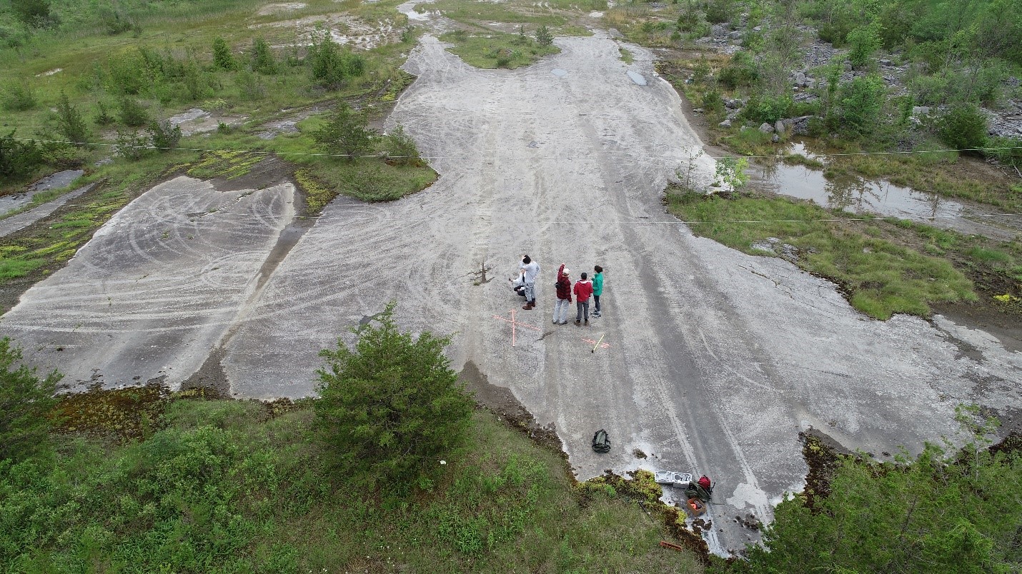
Lucky for the lab members this meant that they could fly the drone! This let them get a birds eye view of past glacial flow directions in the form of mega grooves and striations. The drone footage effortlessly captured the long extent of the mega grooves at the site. It is one of the many ways the lab has been employing the use of drones to gather valuable data on glacial landforms to better understand the glacial history of North America.
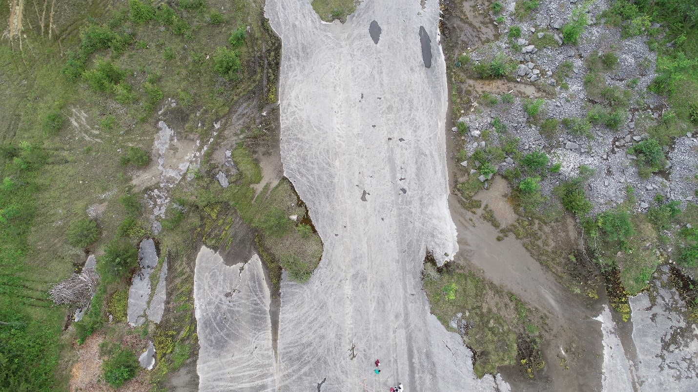
Figure 1-Drone footage capturing the extent of mega grooves (dark linear features) on the rock outcrop.
So what are mega grooves?
They are grooves carved into the bedrock recording the velocity and direction of past ice flows. As ice flows it collects subglacial materials forming an erosive underbelly capable of carving into the bedrock analogous to sandpaper scraping across a surface. The remnants of this process provide valuable evidence for researchers reconstructing the past dynamics of glaciers in the region.
What do the grooves tell us about the glacial history of the area at Odessa?
Since mega grooves record the dominant ice flow direction, the patterns observed at Odessa describe a southwest progression of the Ontario Lobe during the last glacial maximum. However, what goes up must come down or, in the case of glaciers, what advances must also retreat. The crossing perpendicular striations indicate that the Ontario Lobe did not solely travel in the southwest direction but also had a phase with a northwest motion (see the arrows in Figure 2). This likely occurred during deglaciation when the Ontario Basin was relatively ice free, allowing the ice lobe to flow in a different direction. Understanding the progression and behavior of ice flows allows us to comprehend the glacial history of the area as well as current glacial dynamics in glaciated regions.
Figure 2- Over head view of the team walking along the mega grooves with arrows showing cross-cutting features. Grooves flow from bottom to the top of the image while striations are perpendicular.
Want to check it out for yourself?
While you may not be able to view their full extent without access to a drone, even from a ground level view the grooves imprint the sheer weight of the glaciers and their effect on the underlying earth. It is easy to ponder the magnitude of past glacial activity across Ontario, which many of us call home, that could leave such an impression.
If you want to get groovy with mega grooves, check out details about the site using this link and look for “Crossing striations and ‘flow switching’ of the Ontario Lobe” along the highway near Odessa to learn more. To learn more about the general glacial history of Ontario check out the field trip examining Landforms of Southern Ontario where you can find Odessa on Day 1, Stop 5.
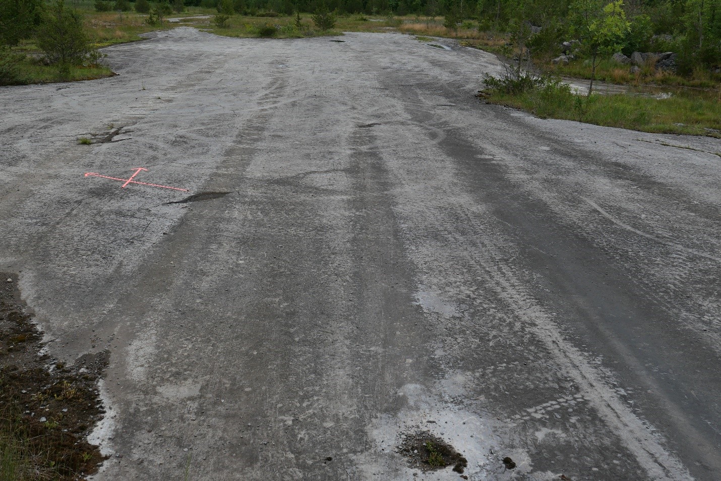
Figure 3- Ground level view of mega grooves at the Odessa site.