At the recent GAC- MAC London 2021 joint annual conference PhD Candidate Shane Sookhan gave a talk titled “LiDAR-based quantitative assessment of drumlin to mega-scale glacial lineation continuums and flow of the paleo Seneca-Cayuga paleo-Ice Stream”. This work covered Shane’s recent PhD work that utilizes high-resolution data to map glacial landforms to shed light on the behavior of past ice sheets that once covered Ontario.
Shane emphasized that the availability of high-resolution LiDAR (Light Detection and Ranging) around the great lakes has created new possibilities for identifying glacial landforms. Contrasting the high-resolution LiDAR data against lower resolution topographic data clearly demonstrates the utility of the LiDAR data for observing MSGLs (mega-scale glacial lineation), linear grooves, which are only revealed in the higher resolution image (1 m) (Figure 1).
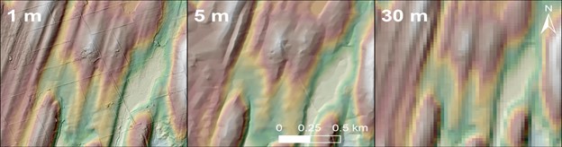
Figure 1- LiDAR (1 m) compared against lower resolution (5 and 30 m) topographic data
Higher resolution outputs allow for automated generation of metrics instructive of ice stream movements. For example, an unsupervised machine learning data clustering technique, called K-means, can be used to group the elongation ratios (length relative to width) of glacial features to generate groups and classifications for interpretation (Figure 2). These help to objectively inform the spatial distribution and characteristics of the glacially influenced landscape.
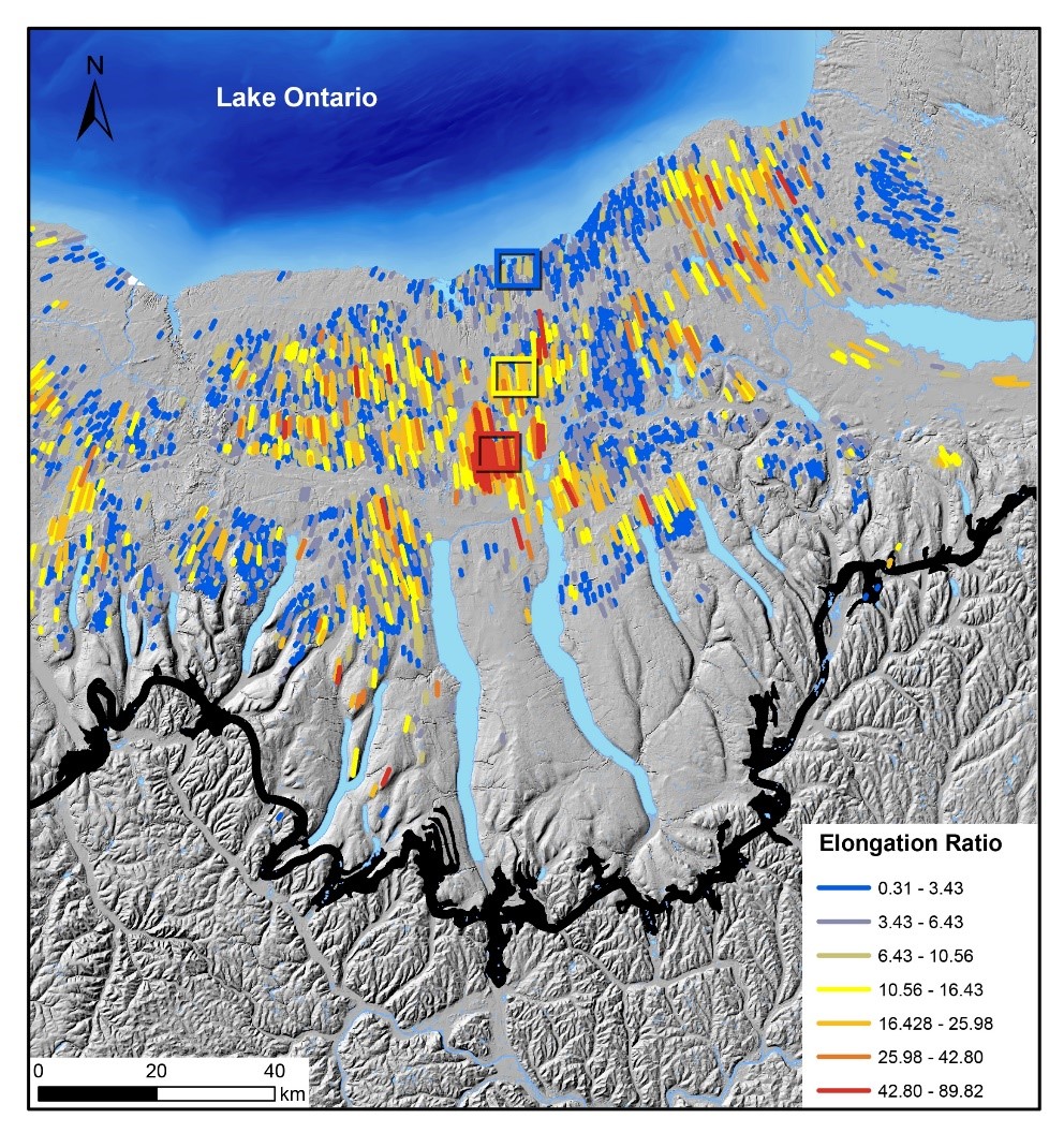
Figure 2-High resolution data allows for the automatic generation of polygons representing glacial landforms which can be analyzed to yield key metric descriptive of ice dynamics such as the elongation ratio.
This particularly helps identify transitions of between glacial morphologies representative of different flow conditions. See the video below for the transition from oblong drumlins to more linear MSGLs describing a shift from slow to fast moving ice, respectively (Figure 3). The evolution between morphotypes, from drumlins to MSGLs, is supported by the existence of statistically validated transitional morphotypes indicating that these features are on opposite ends of the same continuous dimensional gradient. Ultimately, the correlation between morphology and ice dynamics allows for an interpretation of the landscape informing past ice streams. This approach was used to map ice streams projecting south from what is presently Lake Ontario into the Finger Lakes Region in New York State (Figure 4).
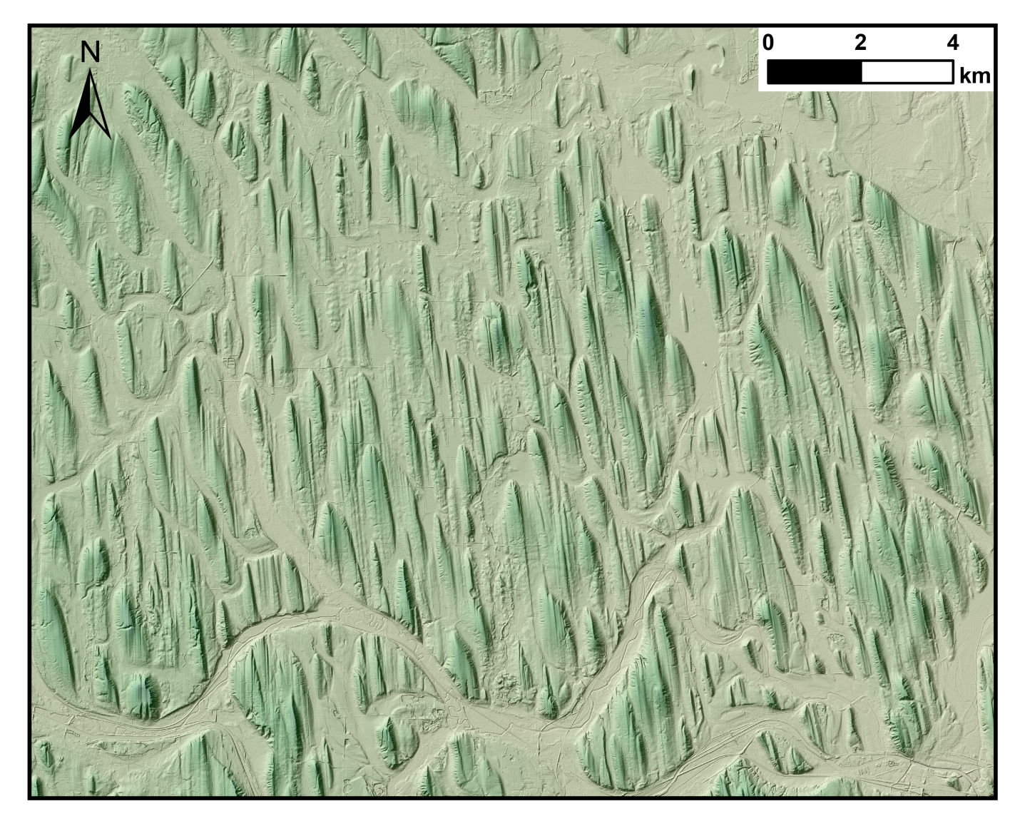
Figure 3- Transition of glacial morphotypes from drumlins to MSGLs.
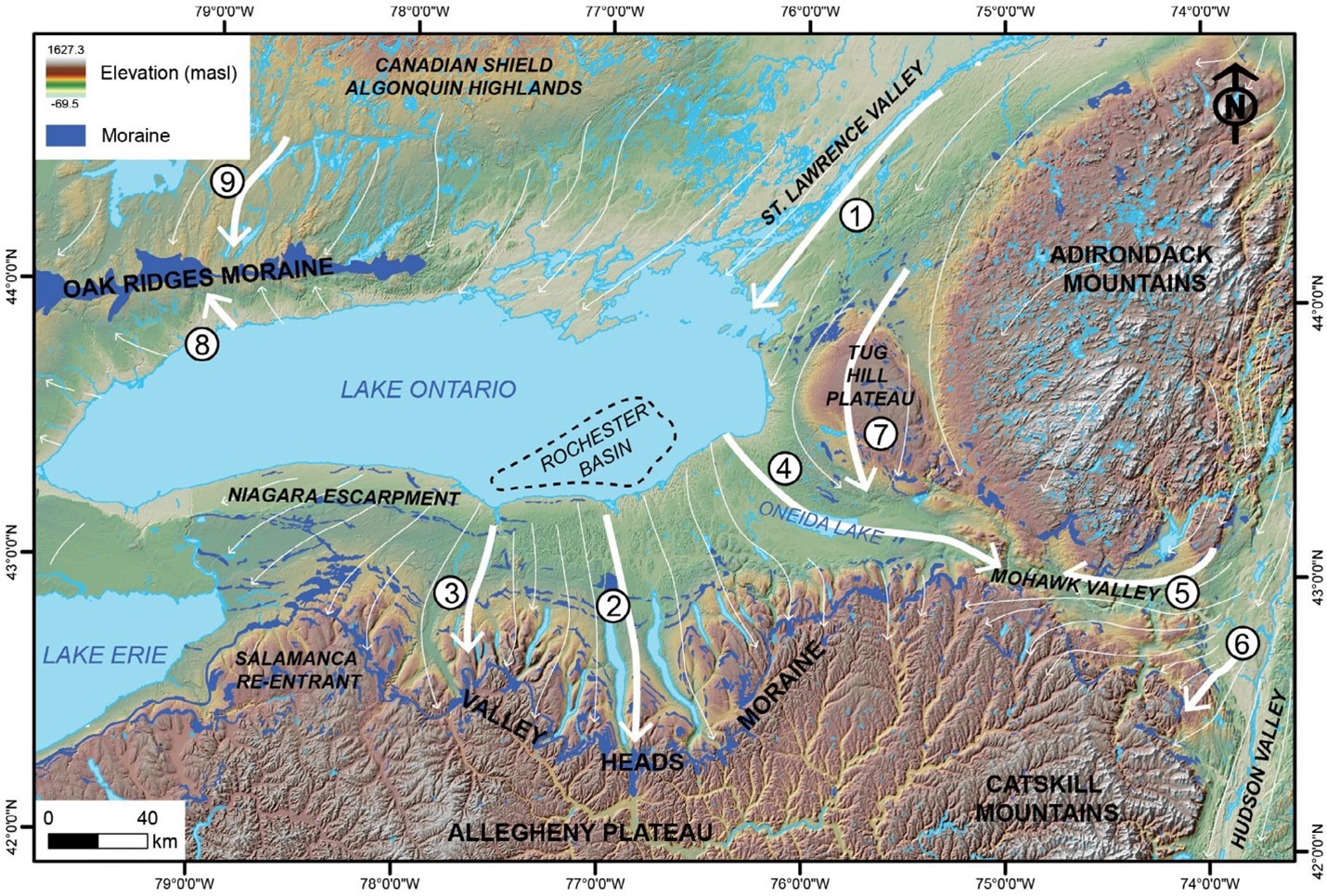
Figure 4- High resolution data allows for an interpretation and reconstruction of ice streams such as the Seneca-Cayuga Ice Stream shown here.
Unleashing high-resolution datasets to map morphotypes has shown to be a powerful tool in determining the paleo-glacialogical structure of ancient ice streams. Shane looks to continue this work alongside the Planet Earth Lab in a new project looking to employ these automated mapping techniques towards creating a new glacial map of northern Canada. Stay tuned to find out more about this and other interesting research projects being tackled by the Planet Earth Lab!
Want to learn more?
If you are interested in Glacial Bedforms such as drumlins and MSGLs check out the virtual field here or Prof. Eyles’ recent post on the enigmas of drumlins.