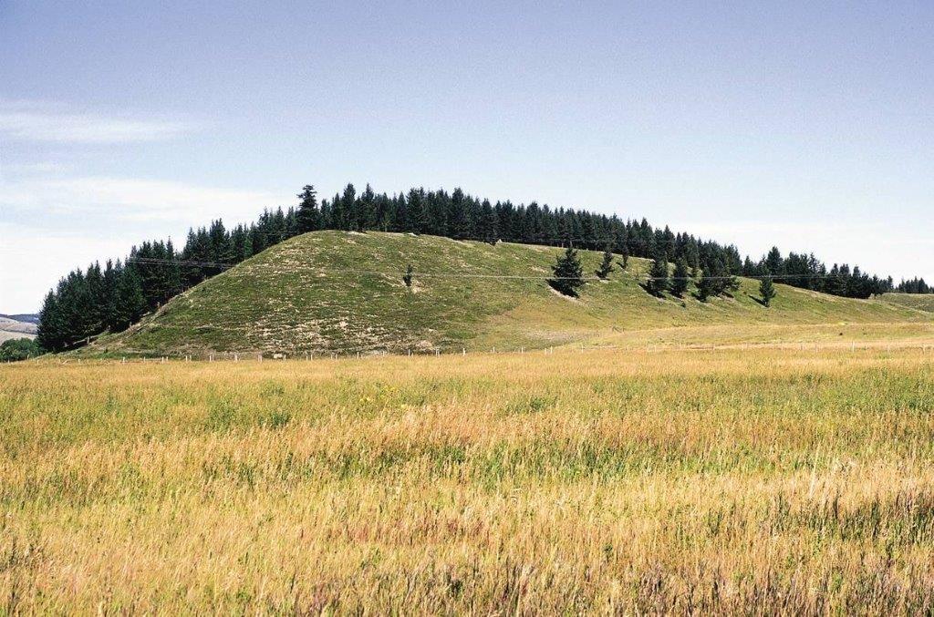
A drumlin!
The word ‘drumlin’ is an old Irish word describing an elliptical tear-shaped glacial hill left behind by the melt of large ice sheets during past Ice Ages. Every geology student will come across them sooner or later, the iconic glacial landform present in densely-packed ‘swarms’ in those areas buried by Ice Age ice sheets. A drumlin’s long axis records the direction of ice flow and is widely used to map the flow directions of the ice sheets. But their origin is enigmatic and controversial.
The Drumlin Debate
Geologists have long debated on the pages of hundreds of publications since the mid-nineteenth century, a solution to the ‘drumlin problem’ and the relative roles of deposition and erosion in shaping these iconic landforms. Some suggest that they didn’t form as isolated features but rather as transitional forms of longer cigar-shaped landforms once commonly referred to as ’megaflutes.’ Satellite imagery reveals many such megaflutes all densely packed together to form surfaces resembling corrugated cardboard, in central and northern Canada, in the US, Britain and Ireland, and Scandinavia. These areas are now linked with zones of very fast flowing ice, many kilometres wide and hundreds of km long, inset within the former ice sheets. Many former ice streams have now been mapped from the identifying distinct ‘flow sets’ and directly analogous forms have been imaged under modern ice streams; drumlins appear to record more slowly flowing parts of the ice sheet. Recent work also points to an erosional origin where patches of more resistant sediment are shaped under the ice by debris being swept across its bed, in effect the layer functions like sandpaper smoothing down irregularities on the bed of the ice sheet, allowing ice to flow more freely. The same features have been discovered on hard rock pointing to the wider importance of erosion, not deposition. But the breakthrough in understanding has come not from glacial geology but, by thinking ‘outside the box’, from engineering and other branches of geology.
Finding ‘drumlin’ analogs outside of glacial geology
It turns out the drumlinized and megalineated surfaces are not unique to the beds of ice sheets but occur, on different size scales, on surfaces that experienced intense friction. Elliptical drumlin-like ‘bumps’ and long groves and ridges, occur at the base of ejecta blankets (the rubbly debris thrown violently out of meteorite craters), on the surfaces of large faults where rocks rubbed together, at the base of fiery pyroclastic flows running down the side slopes of volcanoes, and under landslides and debris flows. All these are the product of a layer of debris being swept across the substrate below; what is called in that branch of engineering science that studies friction (‘tribology’) as an ‘erodent layer.’ It may turn out that the search for a unique glacial solution to the origin of drumlins may have taken glacial geologists down a dead end.
So what now?
New statistical techniques, combined with machine learning approaches for mapping large LIDAR-derived topographic data bases for entire ice sheet beds, are now revealing the full range of streamlined landforms and surfaces produced when large ice sheets engineer their beds to flow easier. Maybe, just, the drumlin problem has finally been solved.
Want to learn more?
Check out the Subglacial bedforms in southern Ontario: from flood paths to flow sets virtual field trip and specifically stop 7 on Day at the Peterborough Drumlin Field to view an example of the characteristics and imprint of drumlins in Ontario.
For an even deeper dive check out recent work done by the planet earth lab on the subject:
Sookhan, S., Eyles, N., Bukhari, S., & Paulen, R. C. (2021c). LiDAR-based quantitative assessment of drumlin to mega-scale glacial lineation continuums and flow of the paleo Seneca-Cayuga paleo-ice stream. Quaternary Science Reviews, 263, 107003–. https://doi.org/10.1016/j.quascirev.2021.107003
Eyles, N., Putkinen, N, Sookhan, S., Arbelaez-Moreno, L. (2016b) Erosional origin of drumlins and megaridges. Sedimentary Geology 338, 2-23.