Early Toronto Islands
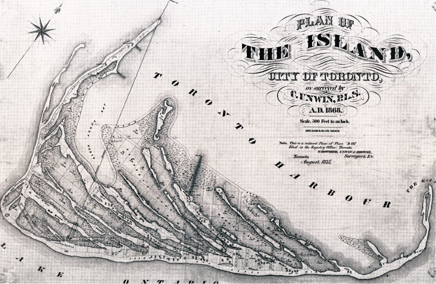
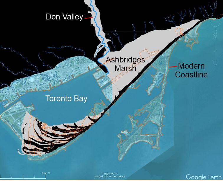
The Toronto Islands were once part of a marshy sand spit growing across the mouth of the Toronto Harbour and being pushed back towards the land. The overall structure was of a series of delicate and ever-shifting sand bars as shown in this image.
Image: This map shows the islands in 1868 prior to large-scale landfilling.

The New Mouth of the Don?
The current iteration of the Don Mouth Naturalization and Port Lands Flood Protection plan calls for restructuring of the Don River to exit near this site rather than through Keating Channel. It is estimated that 1.4 million cubic metres of soil will be excavated.
Image Credit: Waterfront Toronto
Building the Islands
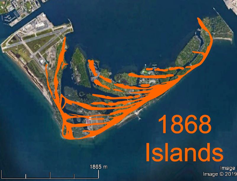
The delicate skeleton of the islands has been filled in and stabilized in order to create useable land with deep boating channels. Compare the outline of the islands in 1868 to the present outline in the image above.
The Depression
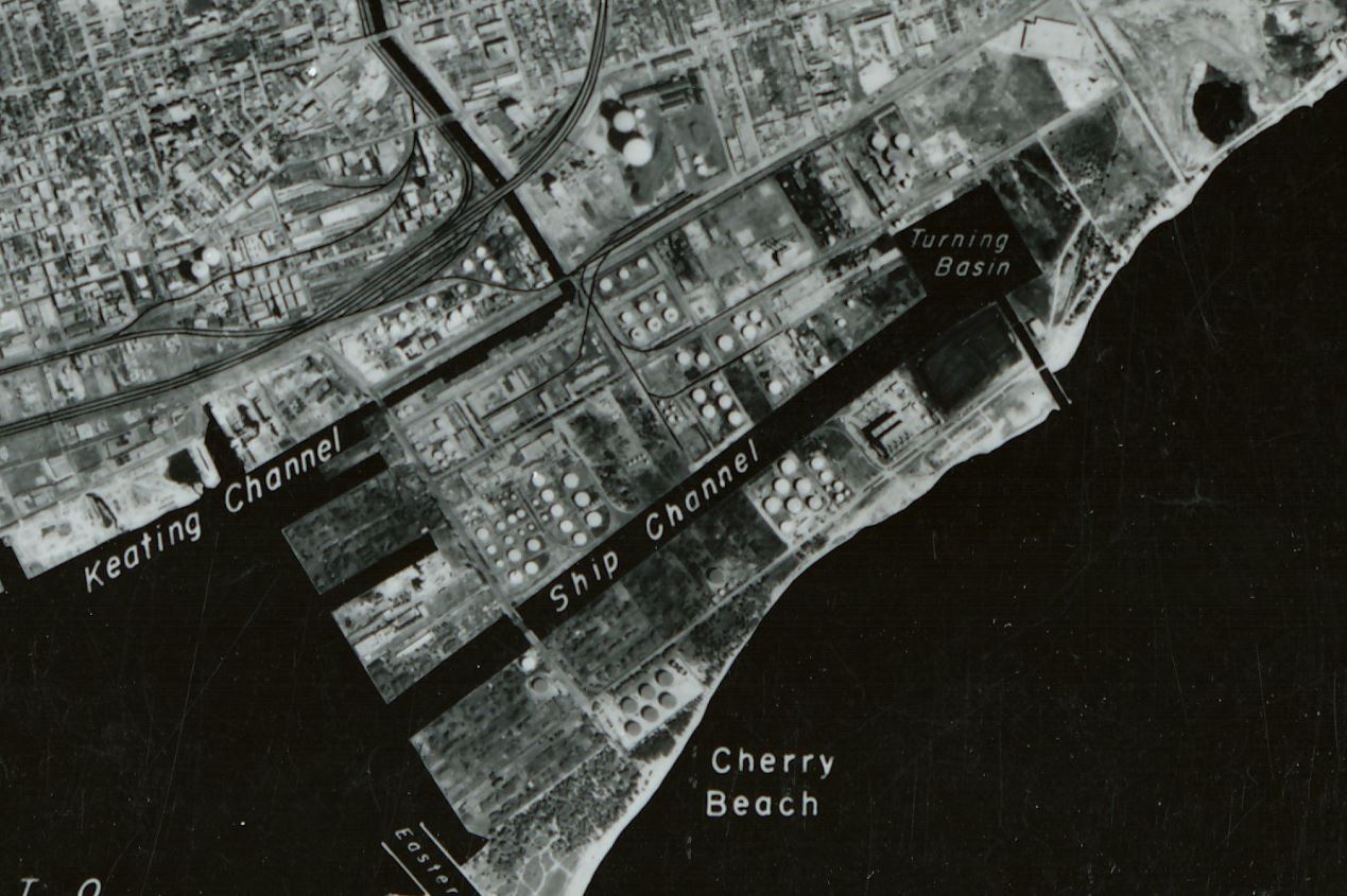
Though for decades it was assumed that the Portlands would be used for light and heavy manufacturing, the depression killed off that dream, and the area was used for bulk storage of chemicals, coal and oil.
The Don Valley
The Don River Valley is one of Toronto's many classic ravines. They are the product of marked changes in lake level. Some 12,500 years ago, much of the Toronto area was flooded by the ice-dammed glacial Lake Iroquois which was some 45 metres deeper (higher) than the modern Lake Ontario. The lake drained very quickly when the plug (ice) was pulled out of the St. Lawrence and lake levels dropped to well below that of the modern Lake Ontario. Rivers had to erode down to this new level creating the narrow ravines that typify Toronto today.
A Tight Corner
The right angle bend in the Don essentially dams the river allowing debris and contaminated sediment to accumulate. It must be be dredged regularly to keep it clear and reduce the impact of flooding.
Ashbridges Bay Waste Water Treatment Plant
This wastewater treatment plant opened in 1910 as a prerequisite for reclaming Ashbridges Bay. It one of Canadas oldest wastewater treatment plants.
Built Land
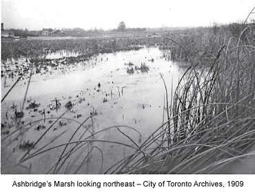
Ashbridges Bay was originally a marshland formed by the build-up of sediment discharged from the Don River.
Image: Ashbridges Marsh 1909. City of Toronto Archives, Series 376, File 4, Item 63
Raising a Stink
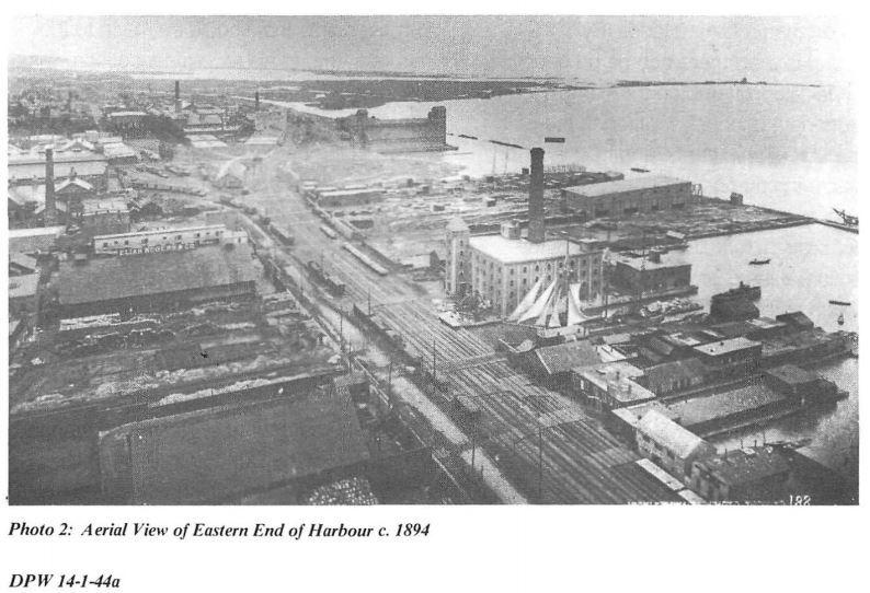
Proposals for "reclaiming" the cesspool of Ashbridges Bay for industrial interests began as early as the 1850's. By the early 1890s, the construction of a breakwater across the mouth of the bay had caused conditions to seriously deteriorate. Public outcry came from the perception that it was a source of cholera, malaria, and typhoid. Industrial interests wanted the bay remediated because it was a prime location close to railway lines, but shipping was being hampered by ever-shallowing waters as silt was trapped behind the breakwater. Clearly, something had to be done.
Image: Aerial view of the Harbour 1894.

Straightening the Don
The sluggish Don River once marked the outskirts of Toronto. It was used as a dumping ground and much like the Ashbridges Bay was seen as a source of filth and disease. The shifting course of the river presented the potential for property damage and limited the use of the corridor for infrastructure. In 1886 a public referendum gave approval to the City to initiate the “Don Improvement Plan" in which the river was straightened and deepened south of Winchester Street.
Image: River Don Straightening Plan, 1886, City of Toronto Archives, Series 725, File 12.
Flood Management
Virtually the whole Portlands District as well as much of the lower Don Valley is susceptible to flooding. Hardening of the Ashbridges Marsh and Don River riparian corridor prevents floodwaters from absorbing into the ground. As a result, this segment of the Don Valley Parkway is notorious for flooding after heavy rainfalls.
1793: Fort York
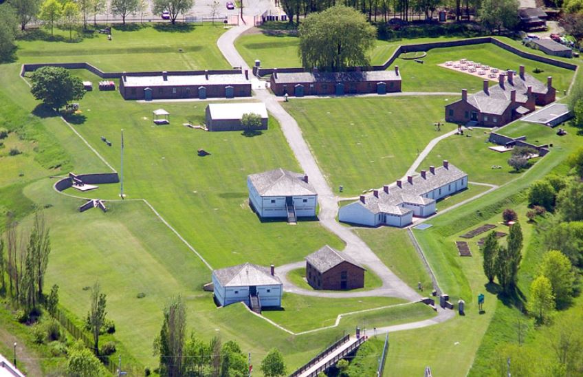
Following the American Revolution, the control of Lake Ontario, and therefore the waterways that connect the Lower Great Lakes with the Atlantic, was of paramount importance. The British recognized the strategic and defensible position Toronto Harbour and used it to shelter their naval base. Fort York was built in 1793, to defend the base.
Image: Fort York Historic CC2.0
1852: A Brewing Storm
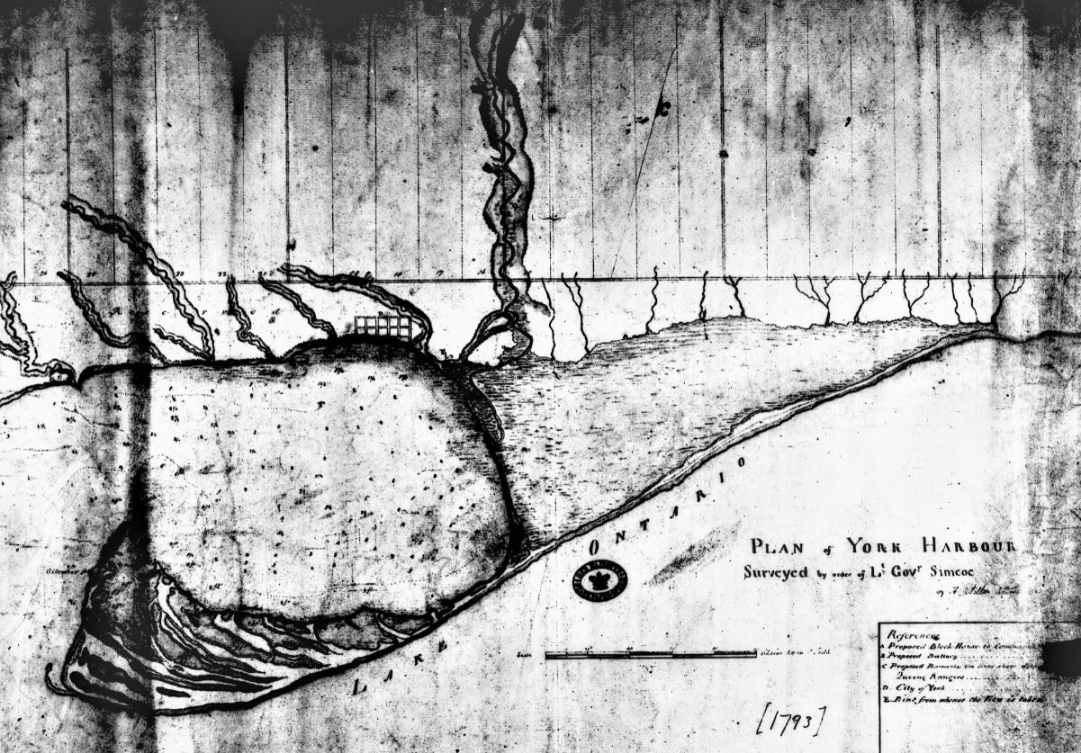
A great peninsula stretching from here to the Toronto Islands was destroyed by storms in the 1850's. The opening of the Eastern Gap heralded one of the most intense periods of development and infilling of the Toronto Harbourfront.
Image: The state of the Toronto Harbourfront in 1793 showing the spit before the storms of the 1850s.
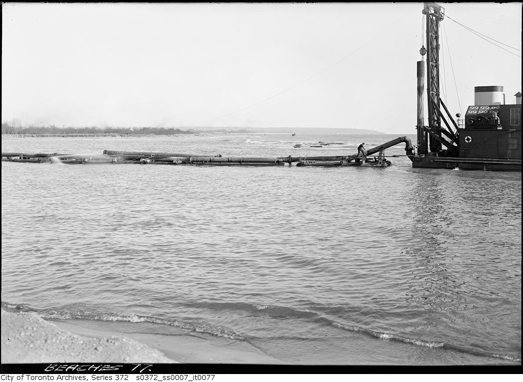
Eastern Gap
We are now overlooking the Eastern Gap. The gap was first broken by violent storms in the 1850s, but later maintained by dredging (shown here). It is approximately 200 metres (660 ft) wide is and is used by most freighters to enter into the inner harbour.
Vying Interests
Contending interests shaped the Port Industrial District. Initially, there was considerable discussion about who exactly would fund the reclamation and who would benefit - shadowy private syndicates or the municipality itself? The majority of Toronto citizens favoured a private solution, but because of the immediacy of sanitary concerns, the costs, and ownership, largely fell to the city.
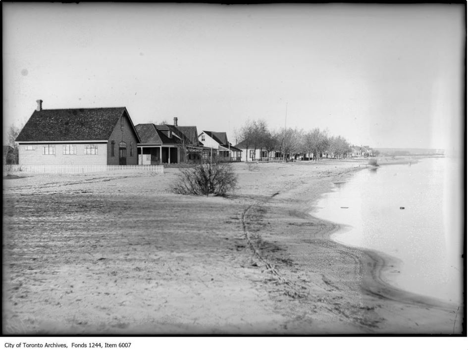
1850's to 1920's: Fisherman's Island
With the opening of the eastern Gap and the Coatsworth Cut, this section of land became an Island disconnected from mainland Toronto. It was called Fisherman's Island because of the commercial fisheries that thrived there.
Image: Fisherman's Island 1909, City of Toronto Archives.
The Port Industrial District
We are now in the heart of the Port Industrial District. This area was once a marshy wetland called "Ashbridges Bay", but it has been extensively filled in and modified over the years as economic interests have changed.
The Last Remnant
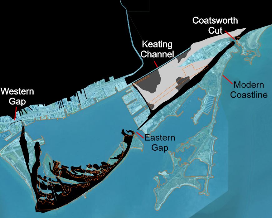
This is all that remains of Ashbridges Bay and also the approximate location of the Coatsworth Cut which was made to improve water circulation and ship access.
Image: Toronto Harbourfront 1906 shortly after the Coatsworth Cut was made.
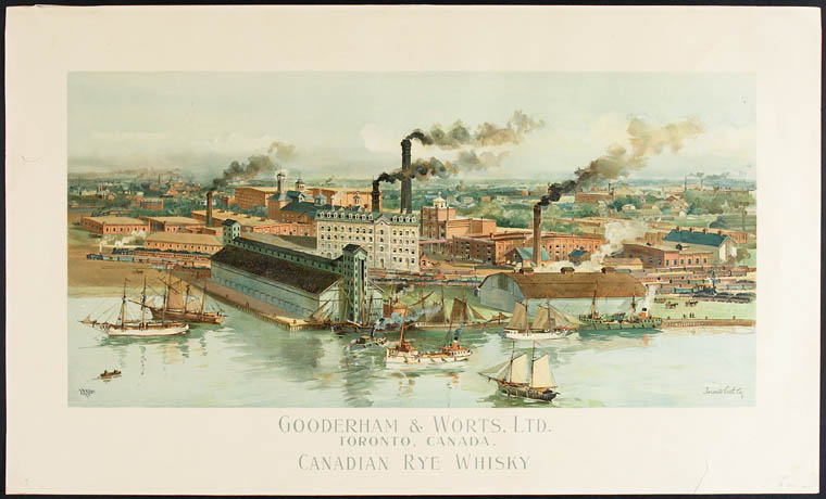
A Total Pig Sty
As the city of Toronto grew, Ashbridge's Bay became a cesspool. Human and animal waste was regularly washed into the bay and prevented from leaving by a breakwater built across the mouth. One of the biggest offenders was the world-famous whisky distiller Gooderham & Worts who disposed the wastes of thousands of pigs and cows as well as grain byproducts into the marsh. In the 1890's the situation came to a head and plans were drawn up to "reclaim" the area for industrial use.
Image: Library and Archives Canada, Acc. No. R9266-1617 Peter Winkworth Collection of Canadiana
Toronto Harbour
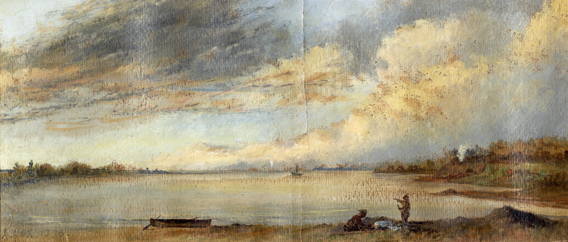
We are currently looking out over Toronto Harbour: the key to Toronto's success as a major urban centre. This is a natural feature that has been substantially developed and modified over that past 300 years as it's usage has evolved. The original coastline, shown in this painting from 1793 was a series of length of low bluffs. Compare that to what we see today from this lookout at Jennifer Kateryna Koval's'kyj Park.
Building the Bend
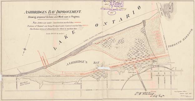
There was considerable debate involving property owners regarding which route the Don River should take to reach the lake. City engineer Keating's original plan was to gently curve the river north of Keating Channel, but the final route constructed in 1912 had the Don run straight southwards to enter the channel at a 90 degree angle.
Image: E.H. Keating's plan for improving Ashbridges Bay, 1893. City of Toronto Archives, Series 725, File 7 (MT995).
1950's-1970s: Construction of the Leslie Street Spit
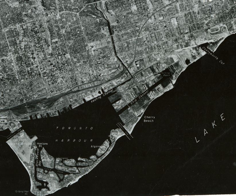
The landfill for the Leslie Street Spit largely came from excavations of earth for the subways and the large office towers of downtown Toronto. It was also the dumping ground for material dredged from the Keating Channel.
Image: Aerial photograph of downtown Toronto prior to construction of the Leslie Street Spit

The Sands of Time
This beach was once a great peninsula formed from sands eroded from the Scarborough Bluffs and pushed along the coast by waves. It's development up until 1850 was illustrated by Sanford Fleming (the inventor of standard time zones and the 24 hour clock).
Construction of the Keating Channel
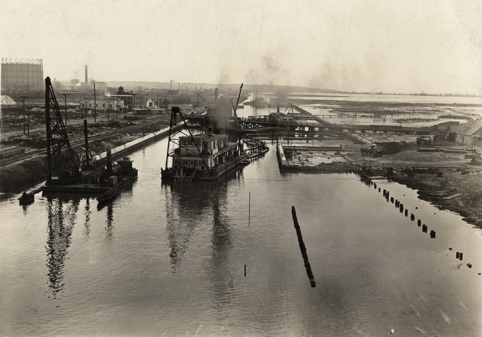
The first step in cleaning up Ashbridges Bay was to cut a path for water to circulate through the marshland. The Keating Channel was dredged out on the north side and the Coatsworth Cut made through the sandspit on the eastern side.
Leslie Street Spit
As home to more than 300 species of birds, the 5 kilometre-long Leslie Street Spit is one of the most environmentally important sites in Toronto. Ironically, it is a man made structure that began as a landfill during the 1950's.
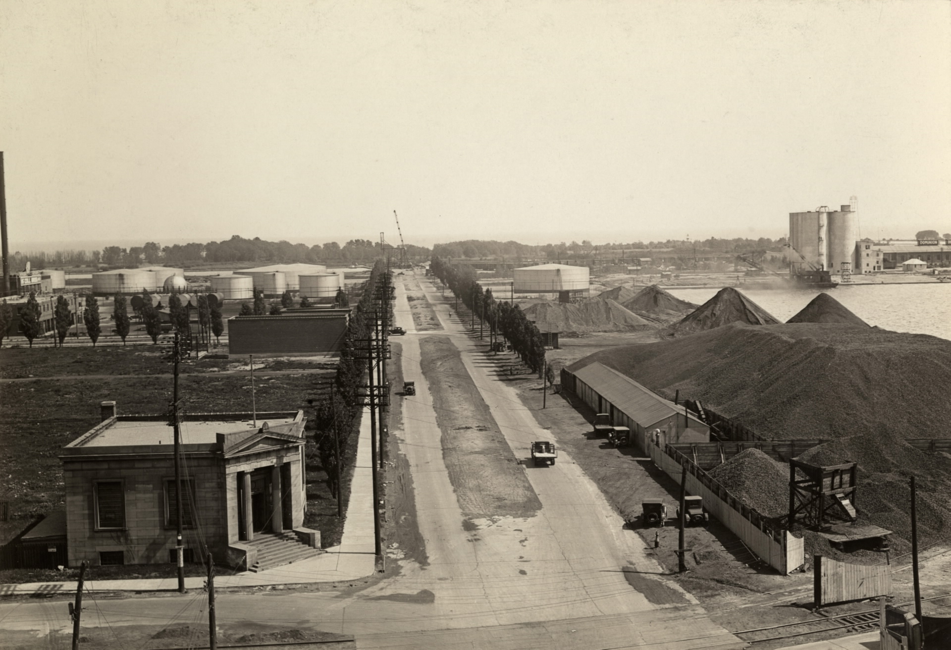
A Bascule Bridge
As the harbours took shape, several bridges were built to connect the docks to the mainland. The Cherry Street Strauss Trunnion Bascule Bridge opens to allow ships to access the channel. It was built in 1930, one year after this photo was taken.
Image Source: Toronto Public Library
Storage
One of the most important functions of the Port Industrial District today is the import and storage of road salt and construction materials.

The Cost of Clean Up
The Portlands now presents a fascinating but nightmarish mix of old docks, laid up ships, abandoned land and recycling plants. Its location close to downtown makes it very desirable to developers but the cost of cleaning the area of its chemical legacy is excessive. In 2017, Waterfront Toronto recieved 1.25 billion dollars to devote to the task.


